Last week Ben, a client, and myself rode the Takesi trail outside of La Paz. Takesi follows an old Incan / pre-Incan highway, winding down from an altitude of 4,600 meters to roughly 2,100 meters into the Southern Yungas valley. It was one of the most physically and technically demanding rides I've done in my entire life.
A short rundown of the day: Hike a bike over an hour up to 4,600 meters (15,100 ft.); ride for 2 hours on an Incan highway (rock garden with rocks ranging from softballs to coffee tables) interspersed with a touch of smooth trail, and more short hike a bike sections; one last short but steep bike on your back hike before descending for over another hour on rocky (but not rock garden) singletrack, followed by a river crossing, another hike, and yet another descent. All told nearly 6 hours including lunch and two flat tires. Usually this trail takes hikers 2-3 days!
I was exhausted by the end of it, over 3 hours (just riding) of steep, rocky, and extremely technical downhill. I could barely pull my brake levers by the time the last hour came around.
But it was amazing, and for so many reasons...!

The first hike, you can clearly see the Incan highway. Sometimes it was wide like this, other times it was merely a narrow trail.

I'm pretty sure this is a Southern Viscacha; a larger cousin of the Chinchilla that is native to the rocky portions of the Andes. We saw a few of these on the first long hike up, they seemed to be relatively unafraid.

Resting at 4,600 meters before the first descent.

First descent, not too rocky here, but that changed about 2 minutes later.

Extremely rocky sections gave way to more "highway". Note the square edge 4" - 10" high water bars every so often. These things can be pinch flat nightmares if you aren't careful.

Then the highway becomes rock garden again.

But it doesn't mean Ben can't get a little air now and then.

Road toll. Seriously.

After the toll we entered a small village (more like a handful of stone huts). The trail was grassy and we could actually sit and pedal for a minute or two!

Yes, people actually live here. And it's awesome!

This was my first time on Takesi. Ben had guided it before and he heard last time from one of the Aymara women that her husband had been killed by an Andean bear. In the village two young guys asked us if we wanted to see the bear that killed the ladies husband and 50 cattle. He led us over a stone wall, across a creek, and to the front of a squat stone structure that resembled a cellar. Then he pulled this hide out! Supposedly this is the offending bear... who knows, but damn it was an impressive experience. They shot it with a revolver!

After the village we rode a short ways and stopped for lunch near this bridge.

We continued on and the trail turned into a steep and off camber path, finally we had our first pinch flat. And yes, this is smooth compared to the first half of the trail.

However, there still are some short rock gardens.

The last really terrible hike a bike.

Resting after the hike.

And then finally we had something a bit less technical. Not smooth, but still slightly more flowing.

But there's still rocks!

And again.

We stopped again for a short snack, then crossed this river. The bridge below this spot was completely useless, so someone put a few trees down all in one spot as a makeshift bridge.

After the bridge we had one last hike that was long, but wasn't too bad. At the top was a single house, and this sign.
We had another 30 minutes or so of riding after the lone house on the mountain. However, I didn't get my camera out again. It was hard enough to interrupt my flow up top as many times as I did, and by this point I was exhausted, so I focused on riding and tried to find enough strength in my hands and forearms to actually use my brakes.
All told, one of the best riding days of my life, maybe the best. If you get a chance, do this ride!

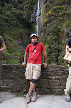
Parting shot near La Cumbre on our way back home.
 Sara, mid photo pose, right before we got on the train for a 7 hour ride. Trains are the most relaxing way to travel!
 Thousands of flamingoes flock to this shallow wetland right outside of Orruro. And you thought flamingoes were tropical creatures...!
 Sara, oh so Vogue!
 Workers loading up raw salt from the flat.
 This guy showed us how he makes salt from the raw excavation of the salt flat. He operates one of two facilities that supply ALL of Bolivia's edible salt. And by facility I mean a shack that is about 15' x 30'.
 Classic Salar perspective photo. It might be derivative but it's still cool!
 Uhh, enter your own caption...
 The "island" in the middle of the flat that has a unique ecology, including these cacti.
 Sara with a hawk overhead. If you're into totem animals, Sara and hawks = eerily spooky and always around one another.
 Two buses in the middle of the Salar.
 Sunset on the Salar. Absolutely the best sunset I've ever seen. It didn't quit! It went on and on for over 45 minutes. Epic!
 We stayed near a dormant volcano the first night. I got up and hiked near the caldera the next morning. Inadvertently, I left the salt hostel (hostel made of salt, go figure) and my guide and just started hiking on my own. Eventually I met up with another group and joined them for about 30 minutes right when they were venturing into this cave to catch a glimpse of about 10 mummies. It's a bit weird walking into a cave and seeing a bunch of dead people, but it was amazing at the same time.
 Last, a classic view of the Salar de Uyuni at sunset.